Pix4Dcapture
iOS Universel / Utilitaires
Pix4Dcapture turns your consumer drone into a professional drone mapping tool. A free companion to Pix4D photogrammetry software, Pix4Dcapture is the perfect tool to automatically capture image data - RGB, multispectral, thermal - for optimal 3D models and maps.
Process post-flight images easily on the cloud or desktop applications, producing georeferenced maps and models that are tailored to many industry needs.
Currently, the app supports and was tested for the following drones:
• DJI
- Phantom 4 Pro V2
- Phantom 4 Pro
- Phantom 4
- Mavic Air
- Mavic Pro
- Mavic 2 Pro
- Mavic 2 Enterprise Dual (Only RGB Images)
- Inspire 1 (Pro)
- Inspire 2
- Matrice 200, 210, 210 RTK
- Matrice 100
- Matrice 600
- Phantom 3 Professional
- Phantom 3 Advanced
- Phantom 3 Standard
- Spark
• Parrot
- Anafi USA with Skycontroller 3 (RGB Images)
- Anafi with Skycontroller 3
- Anafi Thermal with Skycontroller 3 (RGB + Thermal Images)
- Bebop 2 with Skycontroller 2
- Disco-Pro AG with Skycontroller 2
- Bluegrass with Skycontroller 2
Features and benefits:
• Fully automated drone mapping
• Drone telemetry and camera live feed during the image acquisition
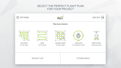
• Different flight plans for different needs
- Polygon Mission for general mapping
- Grid Mission for general mapping
- Double Grid Mission for better 3D model reconstruction
- Circular Mission for point-of-interest 3D model reconstruction
- Free Flight Mission for vertical object mapping with manual flight control
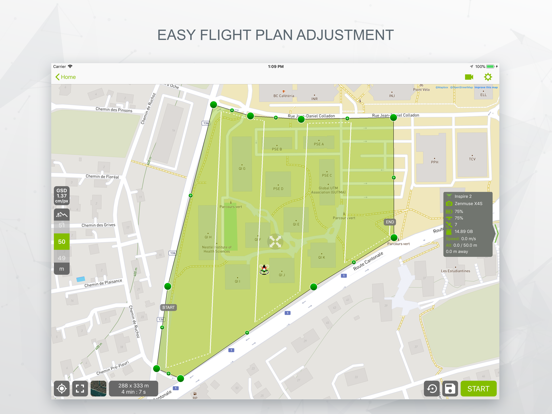
• Flight parameters for each mission - front & side image overlap, camera angle, altitude, GSD, flight speed - can be adjusted based on the requirements of the area.
• Save or duplicate missions to fly the same area of interest several times
• Store the basemap with your flight plan using offline maps
• Change street/satellite basemap provider
• Seamless workflow with Pix4D’s processing software
• Automated image transfer from drone-to-device
• Upload images directly from the device to Pix4D software in the cloud for processing
(license required)
Post-flight processing & analysis using Pix4D’s software on cloud or desktop:
• Achieve survey-grade results from lightweight and compact cameras to large-frame metric cameras
• Usage of Ground Control Points (GCPs) for improving the relative and absolute accuracy of the model
• Generate and modify
- Point clouds
- Orthomosaics
- Digital elevation models (DSM/DTM)
- Index maps (e.g. NDVI)
- And more
• Measure distances, surfaces, and volumes
Usage information
Ensure you have the latest firmware installed and the app is up to date.
The app follows the flight plan and does not avoid obstacles automatically.
Pix4D accepts no liability for damage, injuries or legalities from the misuse of this app. Use only in safe environments.
Quoi de neuf dans la dernière version ?
Fixed a crash when pressing the info button in the take off checklist